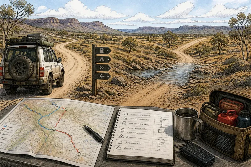
Paper Map or Offline Map for Four-Wheel-Drive Travel?
Compare a paper map with an offline map for four-wheel-drive travel, then choose the format that makes routes, junctions and nearby terrain easier to read.
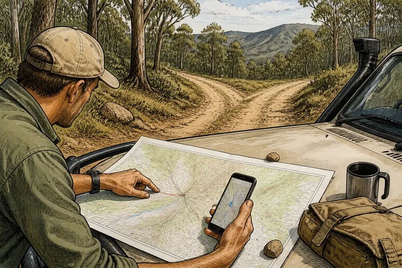
Which is easier to read when a forest track branches: a paper map spread across the bonnet, or an offline map glowing on your phone? For four-wheel-drive travel, comparing a paper map or offline map means weighing the area you can see, how you orient it and how you prepare for an uncertain junction.
A paper map and an offline digital map can describe the same region in very different ways. One gives you a stable overview without a battery; the other can show your position against the mapped area and let you change scale. Start by deciding whether you need a broad view of the terrain or a close look at a particular track.
Paper maps keep a fixed area in view
A printed topographic map gives the sheet a consistent scale. Roads, tracks, contour lines, watercourses and place names stay in the same relationship as you scan across it. That makes it easier to trace a route beyond the next bend and see how a track sits among ridges, valleys and nearby alternatives.
The sheet covers a set area, and its scale determines how much detail it can show. A detailed sheet may show minor tracks clearly but cover less ground; a regional sheet may show more country while simplifying local features. If your route crosses sheet boundaries, you may need adjoining maps to keep the surrounding area in view.
Legibility depends on the print, lighting and your eyesight. Small labels and subtle contour shading can be difficult to distinguish. Use a table, a clean bonnet or a map board as a flat surface, and keep any route markings light enough not to hide junctions or land features.
Paper suits travellers who want an uninterrupted regional view, prefer to scan rather than tap, or do not want a powered device to be their only source of basic orientation.
Offline maps adjust scale and show position
An offline map stored on a phone or tablet can display downloaded map data without a mobile connection. You can zoom in to inspect a fork, then zoom out to see the wider route. If the device’s positioning function is available, a marker can help you relate the screen to the landscape around you.
That flexibility can come at the cost of context. Zooming in may hide the broader route; zooming out may make track detail and labels hard to read. A screen also displays only part of the map at once, so following a route across a large region can require repeated panning. Bright daylight, glare, a dim display or a sleeping screen can interrupt a quick glance.
Before relying on an app, check that its downloaded coverage includes the whole intended area and that the selected map layer contains the road and terrain details you need. Follow the provider’s instructions and any relevant local access rules. Try the screen at the angle and brightness you expect to use, rather than judging its legibility indoors.
Orientation comes from matching the map to the ground
Orientation means lining up what the map shows with the direction and features you can see. On paper, rotate the sheet until its north direction matches a compass or the terrain, then keep the route and surrounding features in view. The sheet will not rotate itself, so notice when you turn or change direction and reorient it.
A digital map may offer a north-up view or rotate to face the direction of travel. North-up keeps the map’s orientation stable; direction-up can feel more intuitive while moving, but the map may turn as your heading changes. Before comparing a ridge or junction with the screen, check which mode is active rather than assuming the top of the display is north.
Neither format interprets the terrain for you. Contours suggest land shape and steepness, but they do not establish whether a track is open, passable or permitted. A mapped line does not confirm current conditions. Use visible landforms and clear junctions to check that your chosen route still makes sense.
Which map suits the view you need?
Which format gives a clearer route overview?
A paper map often keeps a broad area in view, which can help when the route crosses several valleys or branches. An offline map can provide that context when zoomed out, but labels and minor tracks may become harder to distinguish.
Which format is easier for checking a junction?
An offline map lets you enlarge a junction without changing sheets, and a position marker may help relate it to your location. Paper can be just as useful if its scale includes enough local detail and the junction is easy to find.
Can an offline map work without mobile coverage?
It can display downloaded map data without a mobile connection, provided the needed area and map layer were saved beforehand. Open the saved area while disconnected to check it is available, and remember that a visible screen does not prove every track is mapped.
Should you carry both paper and digital maps?
Carrying both can give you a broad paper overview and a screen for close inspection or position checking. If one format would be easier to read and keep available in the conditions you expect, make that your primary reference and prepare it properly.
Prepare either map for the route you will follow
With paper, identify the route and mark only useful references: the start, major junctions, named areas and recognisable land features. Keep markings modest so they do not cover contour lines, track symbols or alternatives. If the route crosses onto another sheet, note where to switch.
For an offline map, save the intended area before travel, open it without a connection and set a useful starting zoom. Save or note important junctions by a name or nearby feature. A route line alone can be hard to interpret when several tracks run close together.
Imagine you are planning a forest road to a ridge, where two tracks branch. You mark the ridge and both branches on a paper sheet, then check the contours to keep the surrounding slopes in view. You also save the same area on your phone, open it in flight mode and zoom in until both branches and their names are readable. The result is a paper reference for the wider terrain and a digital view for the junction; neither confirms that either track is currently open or permitted.
- Coverage: Check whether the paper sheet or downloaded area contains the whole route and nearby alternatives. If it does, keep it ready; if it does not, obtain adjoining coverage or download the missing area.
- Scale and detail: Check whether the tracks, contours and labels you need are visible. If they are, use that scale or layer; if they are missing or crowded, choose another scale or map layer.
- Legibility: Check whether names and symbols are distinguishable in the expected light. If they are, keep that view; if not, use a clearer sheet, adjust the display or change the map view.
- Orientation: Check the north direction on paper or the active orientation mode on screen. If it matches how you are reading the terrain, continue; if not, reorient the sheet or change the screen mode before judging direction.
- Offline access: Check that the saved digital map opens without a connection. If it does, retain it for the route; if it is absent or incomplete, download the area again or use prepared paper coverage.
- Route references: Check that key junctions and recognisable features are marked or saved. If they are easy to identify, keep those references; if a route change could be missed, add a clear note or saved marker.
Choose the format that fits your route-reading habits
Choose paper if a stable area-wide view helps you understand how the route fits into the land and you are comfortable orienting the sheet. Choose an offline map if adjustable scale and a position display make local decisions easier, and you are prepared to save the coverage and manage the screen.
For a route with complex branches, carrying both can provide distinct views: paper for surrounding geography, digital for close inspection and position reference. The aim is not to duplicate information, but to make the view you need easy to reach when the route changes character.
For paper map or offline map preparation, choose around the moment you expect to need a reference: a broad scan before setting out, or a close check at a named junction. Set up that view in advance, then compare it with the visible terrain before committing to a turn.